
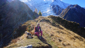
The beautiful Chamonix Valley is one of my favourite places to go. Either for a day for some hiking, shopping and having a coffee or also for a couple of days to be a bit more relaxed and enjoy a nice dinner and some after-hike drinks as well.
As autumn is my favourite hiking season why not combine these two for some good days out in the mountains?!
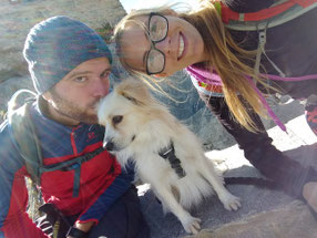
I will share two hikes with you. Each one is possible as a day hike, both are suitable for dogs and do not require any climbing knowledge. I hiked these trails on one weekend and combined them with a little dinner at the Monkey Bar in Chamonix and an overnight-stay in a lovely little Air B'n'B.
Le Signal
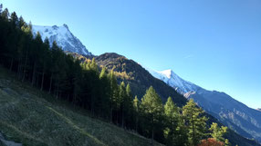
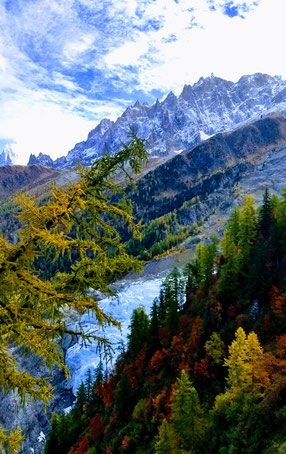
This is a beautiful 5hrs-hike up to a viewing point where you can see Mer de Glace, the biggest french glacier. The total distance is of 15,03km and you should be prepared for a 1200m altitude gain and loss. Anyways, it includes some longer sections without up- or downhill, so you will have some time to relax in between the more strenuos parts.
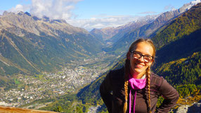
Start your hike from the little (free) parking in the Chamonix City Center. and follow a small path uphill through the forest. (Direction: Blaitiére Dessous). This little alpage offers a nice view to the souther side of the valley. In summertime you can also meet some goats up here.
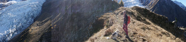
If you climb a little higher from the alpage you will reach the ruins of an old cabin. The view is even better and the spot is even more sunny. Enjoy a little picnic here and the keep hiking towards the Grand Balcon Nord. This panoramic trail is the perfect section to let your pup run freely. before you get closer to Le Signal.
Le Signal is a viewing point above the well-known Montenvers train station. The spot is less crowded and overlooks the Mer de Glace glacier. The view is absolutely stunning and it's a great place for a longer break before you slowly make your way down to the Montenvers station.
This section of the trail is very easy and you will still have a beautiful view to the glacier. Arriving here means also you need to decide whether you want to hike down to Chamonix or take the train down to the valley. The train ticket is 26,00€ per person one-way.
You can also choose to hike down.
Basically you walk this hike backwards! (The first section of the Sunday-hike!)
Follow the trail through the beautiful forest to Chalet Caillet (only open in summertime) and you will reach Chamonix after round about 5 hours of hiking. This section is whether very steep nor challenging but it provides great views to the southern side of the Chamonix valley every now and then and therefore absolutely worth hiking!
Total distance: 15,03km
Total ascent/descent: around 1200m
Download the GPS track below!
Glacier Bossons/Taconnaz
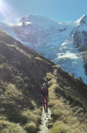
Another hike of around 5 hours getting you up to the Glacier des Bossons and the Glacier de Taconnaz. The hike is slightly shorter than Le Signal, I measured 10,6km for this hike.
This hike starts at Le Mont on 1156m above sea level. This spot is located a bit outside of Chamonix. There is a small parking lot, if there is no spot available, leave your car at the parking of the cable car around 100m downhill. (Please do not block the street, of course ;) )
Hike through the forest uphill. The first section of this hike is very steep, but the path is well-marked and easy to walk. As soon as you reach the street turn left and follow the trail to the Chalet du Glacier des Bossons. (It's at 1425m, don't miss the viewing point on the terrace for the first great view of the Glacier des Bossons.)
From now on, the trail will still go through the forest, always keep right and it's going to be even a bit steeper. You'll gain some altitude within a few minutes, as well as you'll have more great views of the glacier.
Follow the path up to the Chalet des Pyramides. This Chalet offers no refreshment, but a very tiny terrace on 1895m above sea level.
Again, it comes to a decision for you: do you still have some power left? Then take the path direction La Jonction (no worries, you're not gonna go all the way) or start your hike back down.
But: if you keep on climbing, you'll reach one of the best views possible!
The first section of this part is quite challenging, especially when the weather conditions include rain or even light snow, so be careful when going up the wooden steps and stoney passages here. Make sure to use your hiking sticks!
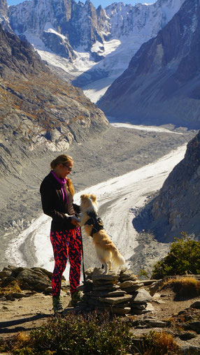
On top you will be able to spot not only the Glacier des Bossons, but also the even more impressive Glacier de Taconnaz and of course the Mont Blanc!
The hike goes back on the same trail and after around 5 hours of hiking you will reach Le Mont again.
Total distance: 10,6km
Total ascent/descent: around 1050m
Download the GPS track below!
Finishing up your day
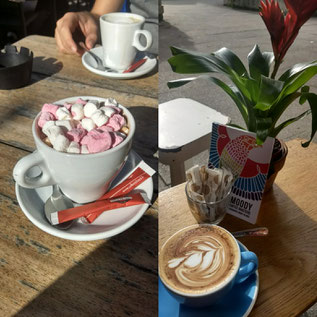
For me, there is less better than finishing a hike with some nice treats :)
In autumn most of the cabins and restaurants on the trails are closed, so I always try to find a nice coffee place afterwards.
As you know I love Chamonix ad for this time I would like to share two recommendations with you:
Try the Moody Coffee Roasters for some real good high quality coffee in a cozy place or sit down on the sunny terrace of L'atelier Café for a hot chocolate with marshmallows and a waffle!
Want to see more pictures?
Make sure to follow my Instagram-Account @lifeisaluckybag as well as my Facebook-Page!
Kommentar schreiben
Mags Nixon (Sonntag, 15 Oktober 2017 23:24)
Great hikes & beautiful photos! We've only been up to the chalet du glacier du bossons with the kids but would love to follow the trail up to the Jonction! Back in Cham in Dec. And yes completely agree Moody's is a fab coffee! Great post. Thanks